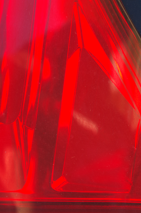
Pentax K-50, 100 mm macro lens. Rotated but otherwise unaltered.
Pentax K-50, 100 mm macro lens. Rotated but otherwise unaltered.

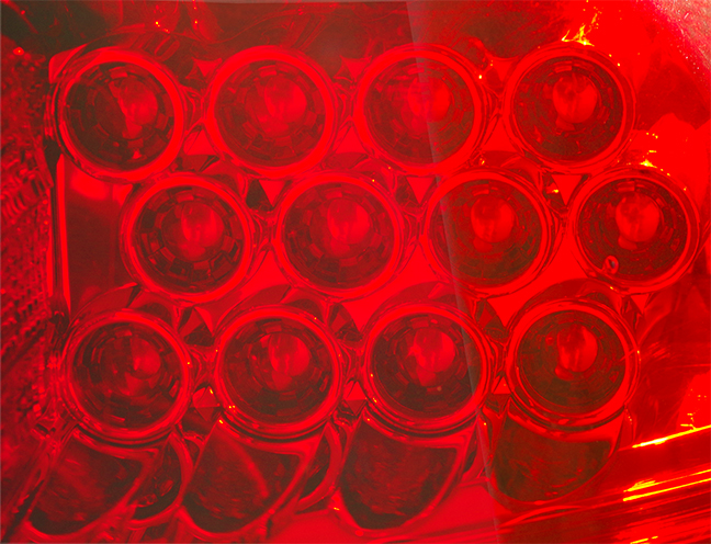
Pentax K-50, 100 mm macro lens. Cropped, slightly color manipulated.

Pentax K-50. Tight crop, slightly color intensified.
Pentax K-50, 100 mm macro lens.

iPhone photo, cropped, color intensified.

iPhone photo, cropped, color intensified.

Streamside on Fall River cabin

Fall River, Estes Park. In Southern Illinois we would call this a creek.

Beaver Meadows, Rocky Mountain National Park

Rainbow Curve, Rocky Mountain National Park

chipmunk at Rainbow Curve

At Forest Canyon overlook, Rocky Mtn. Natl. Park
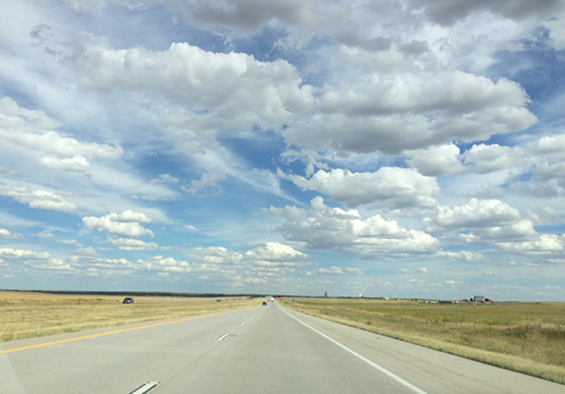
Heading home: eastern Colorado
Day 12: Estes Park to Colby.
Yesterday evening was the sort of evening that reminded me of the disadvantages of solo travel, and today was the sort of day that made me grateful I was traveling alone.
After splurging on a cabin (technically, I had one-third of the cabin) on Fall River just west of Estes Park, I went into town, had a bite to eat, and then tripped on a step I didn’t see. Down I went on the concrete on my palms and knees. The only thing I remember thinking, other than “I can’t stop myself,” was “How will I get home?” I was close enough to the café to call for help; two of the wait-staff brought me ice and got me to my feet. I found out that I could drive if I was careful. I got back to the cabin just in time to catch the manager, who was on her way out, and she kindly brought me more ice and towels. I spent the rest of the evening feeling thankful that I hadn’t broken any bones or hit my head, and that it seemed I’d be able to drive a longer distance than the three miles from the middle of Estes Park to the motel.
The next morning I headed, somewhat gingerly, for Rocky Mountain National Park. I intended to spend only an hour or so. I wanted to visit the place where my sister and I had scattered our parents’ ashes 12 years ago, but I wanted to leave early and drive as far home as I could, because my calculations had shown me that, once again, I was due to reach Kansas City on a Monday or Tuesday, precluding a return visit to the Nelson-Atkins Art Museum for the sixth consecutive time. So I determined to drive two long days and get to K.C. on Sunday.
In the park, however, I took a wrong turn and found myself heading up into the mountains on Trail Ridge Road. That’s okay, I thought, I’ll just go as far as Rainbow Curve (the second major overlook from the east), see how I handle the altitude, and turn around.
I handled it fine. It felt so good, in fact, and the weather was so cool and delightful, that I made an abrupt change of plan: I’d drive all the way across the park, come down to I-70 on the west side, stay the night somewhere, do things in Denver for a day or two, and stretch out my arrival in K.C. to Wednesday.
By this point in the trip I felt that my 10-year-old Prius and I were practically fused, a virtual woman/machine hybrid. We were at one with each other, it seemed. Until Rainbow Curve. Shortly after I pulled out of the overlook, the car began laboring badly. I nursed it along, hoping it would shake off whatever the problem was. No such luck. At Forest Canyon overlook, 11,700 feet above sea level, I decided to turn around, get the Prius back down to Estes Park, and see if I needed to find a mechanic.
In town I got lunch at a place I’d noticed called “You Need Pie!” Yes, I did: that was truth in advertising. The car had no pie but seemed to be doing better nonetheless, so I headed toward Denver, a route that descends from about 7,500 feet to about 5.000. And soon the car was running normally again. I reverted to my original travel plan: drive like hell toward Kansas City. The car and I ended up in Colby, Kansas, together, reconciled, and back in our own time zone.

Day 1: From Carbondale to Boonville.
Good lord but that A&W root beer was sweet. Most of that is going down the drain. I’m in the Comfort Inn in Boonville, Missouri. I’d hoped to make it to Independence today, but I hit the wall in Boonville. I didn’t sleep last night, and today I drove several hours after dropping off the dogs at the kennel.
Utter exhaustion led to utter lack of will power, which in turn led me to order fries with my fast-food sandwich for the first time in…well, I don’t know when. And I drove three miles into town to get the root beer, because who knew that A&W restaurants still existed? But I can’t drink things that sweet anymore, it seems. This town is built on hills; it must be close to the Missouri River. (Later confirmed that yes, it is.) Even the drive-throughs are hilly. I noticed in passing that Yummy’s Donut Shop sells kolaches. I’ve forgotten what those are. Must Google it, since nobody in Carbondale, to my knowledge, sells kolaches. Are they Polish? (No, Czech.)
Nothing of note appeared on this leg of the journey, with the exception of two blue state highway signs between Wentzville and Columbia that said “ATTRACTION EXIT XX” but then had nothing listed underneath. Did these benighted places once have an attraction which then eroded, got up and left, or in some other way disappeared, or is the Missouri Department of Transportation unduly optimistic that an attraction will someday appear in the vicinity of these exits?
The only other notable thing is that I spent a good chunk of change before I even crossed the Mississippi by stopping at a Best Buy in Fairview Heights to purchase the iPad Mini 2 and keyboard folio on which I’m writing this, under the illusion that I will actually document this trip. My other excuse was to use the iPad to serve as a backup for the photos that I will ostensibly take. So far I’ve only taken some iPhone photos of the right front end of some monstrous pickup or SUV that parked next to me at the Boonville rest stop. (See example above, which I like despite its technical flaws.)
Some of my vacation photos may be a little different from the norm.
So here’s the deal: Despite my lousy physical condition, I decided to take a road trip. I’ve been hankering to go on a road trip for at least a year now. My family took road-trip vacations every year in a fully packed VW Beetle (this would now be considered child cruelty) and later a VW Squareback. Such a practice either turns a child against road trips for life or puts a nostalgic love of road trips into a child’s blood, where it causes lifelong wanderlust. In my case, it’s in my blood.
But various things caused delays, most notably something that wasn’t in my blood: iron. It took a year and a seemingly ridiculous number of tests for a family practitioner, a gastroenterologist, a rheumatologist, and a hematologist to collectively rule out explanations, both mundane and ghastly, for my severe iron-deficiency anemia. (The final diagnosis: Iron-deficiency anemia of unexplained cause.) The delay also included a three-month trial on iron supplements. Those supplements did very little, so just over 12 months after my anemia was discovered, I finally had a series of iron infusions that brought my iron levels up to normal. This newfound normality (my sister might suggest noting here that I am normal only in this one respect, so there you go) didn’t seem to give me any energy boost, but I was determined to attempt this trip nonetheless.
I live in southern Illinois, and my primary goal was to travel to Fort Collins, Colo., to see if it might be a good place for me and my sister to move. My second goal was to find some lonely back roads in order to match my mood over the past few months and years, which I would describe as “high lonely.” My third goal was to take photographs, and my fourth was simply to see if I could carry out what I planned. So I prepared to spend as long as a month on the trip, because I knew I’d need to build in time for periodically crashing at a motel and sleeping through the next day.
There were some bad days and a couple of scares, but: I did it! And it was great. It’s fortunate I was alone, because I changed my plans frequently, sometimes on the slightest of whims, sometimes depending on how I felt at the time, and once on account of the car (more of that later). Only the most easygoing companion, someone with no agenda whatsoever, could have put up with this. For me, it was liberating. I didn’t have to worry about whether someone else would object to a given route, or a given activity, or a given eatery, or a given anything. So I planned well but I also did what I pleased, some of it on the spur of the moment. The trip didn’t rid me of my desire for a life partner, but it proved decisively what shorter solo trips had hinted: Solitary travel has its joys. I savored them.
The trip by the numbers:
Miles: 2,625
Days: 15, 3 1/2 of which were spent crashed at a motel
Photographs taken: don’t know; more than 1,000
Photographs saved: somewhere around 600; much more pruning needed
Average temperature: hot, but tolerable due to the much lower humidity
Highest elevation reached: approx. 11,700 feet, Forest Canyon overlook, Rocky Mtn Natl Park
Cost: yes 😦
Next up: some photos and some of the writing I did while on the road.
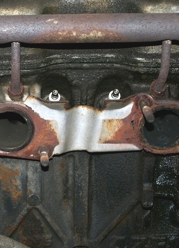
This is a detail of the engine block at the interface with the exhaust. I call it “Totem” for, I think, obvious reasons. I did just a little teasing in Photoshop to brighten the washers (I suppose they are washers) around the bolts.
Speaking of teasing, I realized yesterday that I’d forgotten a crucial exchange in my recent post God’s name is George, so I felt compelled to rewrite the ending (for those of you who read the post and are interested). Like Dave Barry, I didn’t make it up.
