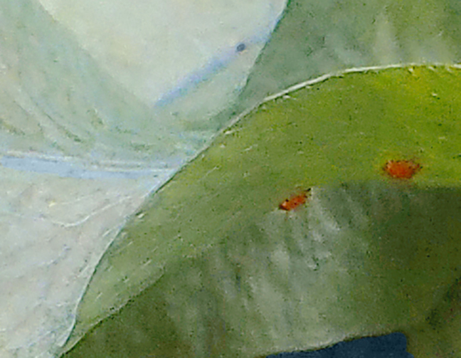
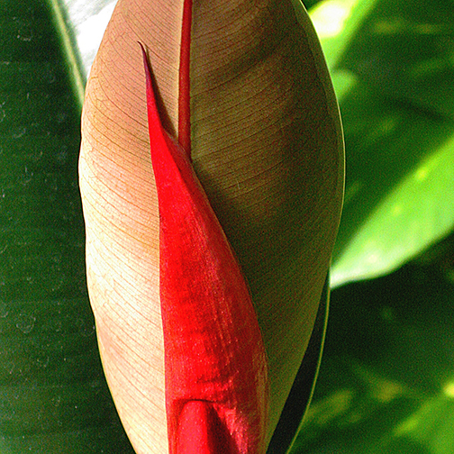
Leaf abstract
Williams Conservatory, University of Wyoming, Laramie. Watercolor filter applied; resampled.
Leaf abstract
Williams Conservatory, University of Wyoming, Laramie. Watercolor filter applied; resampled.

Looking west over the Beartooth-Absaroka Mountains from Rock Vista Point
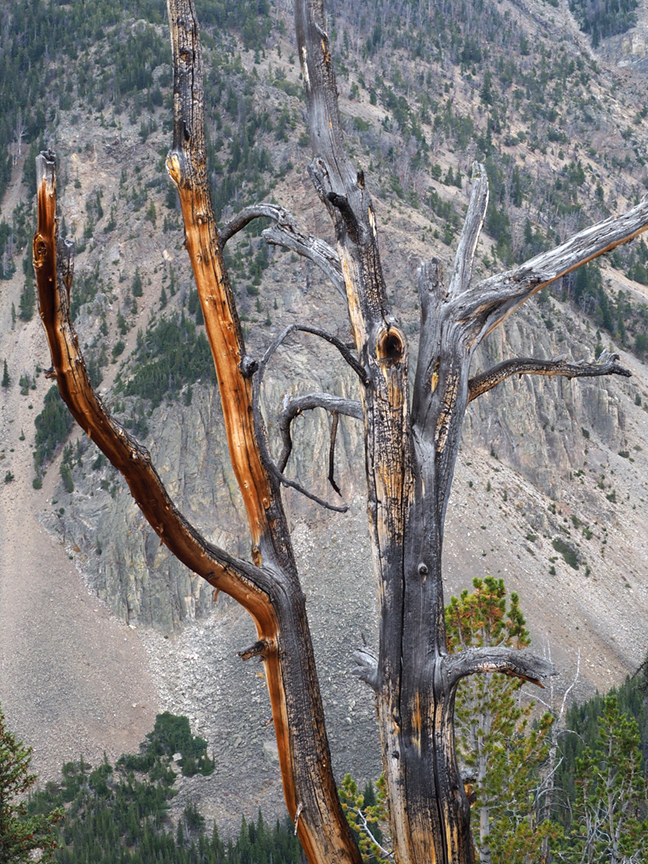
Tree against bare mountain slope
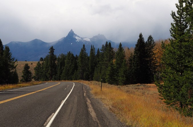
Picking my road trip back up where I left off: On Day 3 I took the Beartooth Scenic Byway from just southwest of Red Lodge, Montana, to Yellowstone. I’d heard how beautiful this route is, and even though the day was foggy, rainy, and finally snowy, what I’d heard was true. This is, according to Wikipedia, the highest-elevation road in Montana or Wyoming, and somewhere recently I read that the rocks exposed at Beartooth Pass (elevation 10,947 feet) are Pre-Cambrian, making them some of the oldest exposed anywhere in the lower 48 states. The drive is through glaciated terrain. Near the top of the pass is a large plateau with many small alpine lakes. It started snowing as I drove across the plateau, and at the pass itself the view was totally obscured. The wind was up and the temperature was down to 28 degrees, so I didn’t venture out of the car.

Plateau east of Beartooth Pass

Snow at Beartooth Pass
The weather gradually cleared as I descended the west side of the pass. Aspens, a waterfall, and distant peaks made this a beautiful drive. The highway, which begins in Montana and then dips down through Wyoming, curves back up to Montana and the small mountain town of Cooke City, where it was snowing. Heading out from Cooke City, you come to the northeast entrance of Yellowstone National Park.

Aspens west of Beartooth Pass
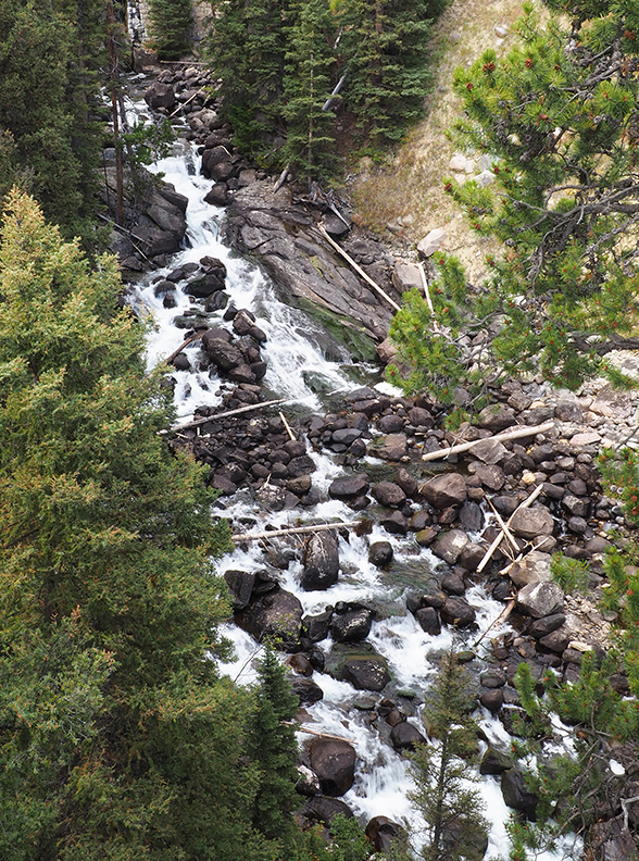
Waterfall west of Beartooth Pass
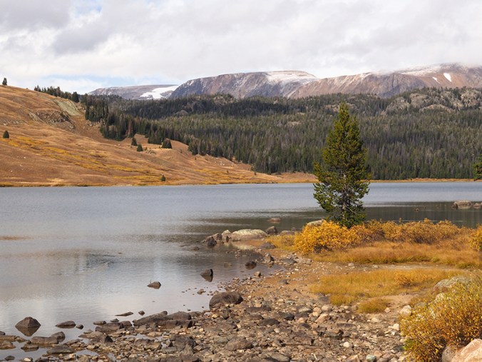
Lake west of Beartooth Pass
Pilot Peak
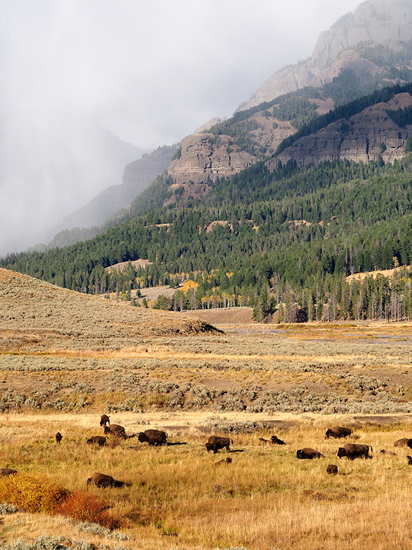
Almost as soon as I entered Yellowstone, I spotted two bison near the road. I was delighted. Well, little did I know that two bison were nothing compared to what was coming: whole herds! Buffaloes on the road, even. Buffaloes spread all across the Lamar Valley, where the snow had stopped, the sun had come out, and the meadows looked golden.

Buffalo closeup
Looking east from the Lamar Valley toward the Beartooth Mountains

Braided river in the Lamar Valley
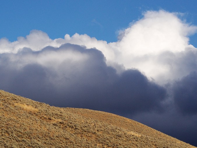
Cloud view to the southwest
As I got close to Mammoth Hot Springs, I could see steam rising from the far-off terraces. In town, elk were hanging out on the grounds of the local clinic. A couple of weeks earlier, a tourist had drawn the ire of a bull elk here and narrowly escaped injury. I parked at the clinic for a few minutes, where this bull elk was bugling and keeping his little harem pointed in the direction he felt was suitable. The sign in the clinic window, which I didn’t notice until I was looking at these photos, reads: “Elk present?!?! Use back door.” This elk certainly looked and sounded like he didn’t want to be trifled with, and I took this photo through the windshield. Tomorrow: Hot springs and geysers!

Bull elk, Mammoth Hot Springs


For this year’s aspen photos I drove the 24-mile Guanella Pass Scenic Byway from Highway 285 north to Georgetown. The road starts out gently on the south side of the pass and gradually ascends. The aspens were at their peak, and flowers were still blooming here and there.


It was a beautiful Friday. These photographs show no hint of the sizable crowds at the Summit Overlook (elev. 11,669 feet); this is definitely “curated” reality. Something I’m learning about Colorado in 2018: There are now so many people driving the drives and hiking the trails that you must be a very fit person to find solitude in the mountains. Every trailhead I passed in eight hours of driving, from Highway 285 up through Clear Creek Canyon, had a pretty full complement of cars. A number of people were hiking the Square Top Mountain trail (below), which originates at Summit Overlook on Guanella Pass. It was an unusually warm day, probably at least 70 degrees at the pass and breezy.
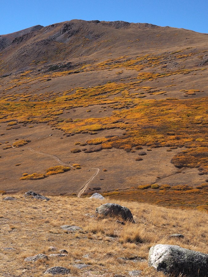
Square Top Mountain and trail
I don’t know what kind of plant this is. Lots of noise in the image, but I still like it. Photo taken at the Southern Illinois University greenhouse in Carbondale. Canon PowerShot S40.
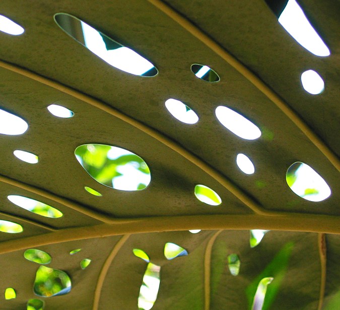
Leaf with holes
That isn’t a typo, it’s a dreadful pun. This photo was taken many years ago at the St. Louis Zoo butterfly house. Canon PowerShot S40.

Light through leaf
Taken with a Canon PowerShot S40; cropping and slight manipulation in Photoshop.


For yesterday’s drive I skirted Denver on the west side and took U.S. Hwy. 285 over to Kenosha Pass and down to South Park. I’d been keen to see this part of Colorado ever since I read a magazine writer’s comment that, though he’d been many places in the world, the view down across South Park from the pass was his favorite. Not ever having watched the animated series “South Park,” I didn’t know that it was named after a real place. (There is also a North Park, northwest of Rocky Mountain National Park.) The designation “park” here refers to a broad plateau or basin ringed by mountains.
I stopped to eat lunch at Fairplay, then took state route 9 up through Alma (10,578 feet elev.), and over Hoosier Pass (as it turns out, there are two Hoosier Passes in Colorado, both of them—I presume—originally sited in Indiana, then trucked west and greatly enlarged). A series of hairpin turns on the other side of the pass takes you down to Breckinridge. There were still golden-leafed aspens along 285 east of Kenosha Pass and in Breckinridge; elsewhere, the aspens were mostly bare. Given the abundance of stands on the slopes, it must have looked spectacular a couple of weeks ago. Now I know an ideal driving route for seeing the fall colors in Colorado.


These photos were taken at the Cathy Fromme Prairie Natural Area, just south of Fort Collins, Colo. This acreage, which has never been plowed, is bounded by two major roads to the east and west and by housing developments to the east and north. It’s lovely country, but the traffic noise is omnipresent. When I had walked about 15 minutes, it began thundering persistently, so I backtracked to the parking area. I didn’t get photos of the many flowers still in bloom, many of them very small and easy to overlook.


Yesterday I took my sister for a 7-hour drive to see the aspens in their fall colors. We drove from Loveland to Boulder, up Boulder Canyon, down the Peak-to-Peak Highway, up Hwy. 40 to Granby, up Hwy. 34 to Rocky Mountain National Park, and across Trail Ridge Road. We didn’t stop for photos very often, but here are a few.

Taken at the Missouri Botanical Garden’s 2017 orchid show. Olympus OM-D EM10 II with 30 mm macro lens (60 equivalent). I recently acquired this 4:3 mirror-less camera (which somehow stands up under the burden of that absurd series of letters and numbers), and so far I absolutely love it. It’s lightweight and small, which is a boon for my tendinitis-weakened wrists, but it seems to perform as well as my Pentax K-50. Best of all, you can shoot just by touching the LCD screen where you want the sharpest focus to be. No, Olympus didn’t pay me to praise this camera. What a shame! Next up: Orchids! Lots of ’em.
