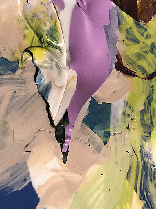
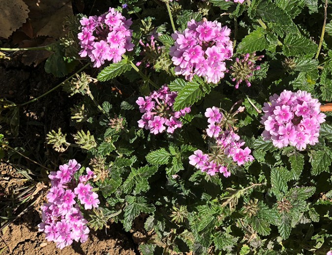
Orchid palette
Orchid palette

On a bar of a grate on a bridge…
This super-saturated photo is of a peeling bar on a grate on a bridge on the Beartooth Scenic Byway.
This too is Yellowstone
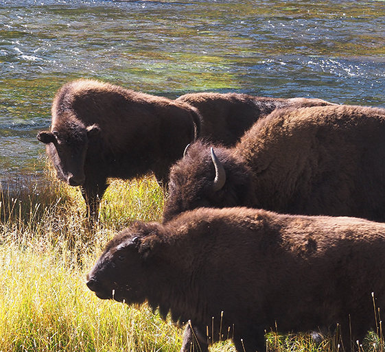
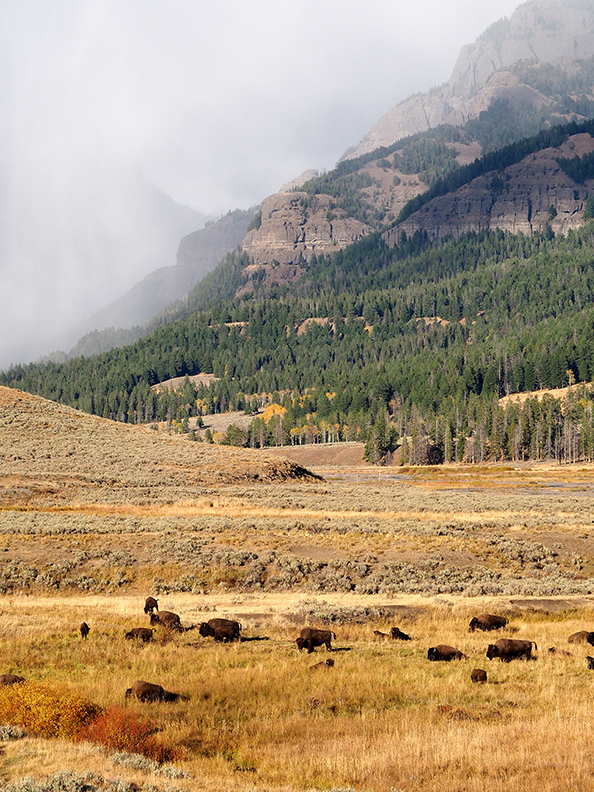
Buffalo herd by the Madison River
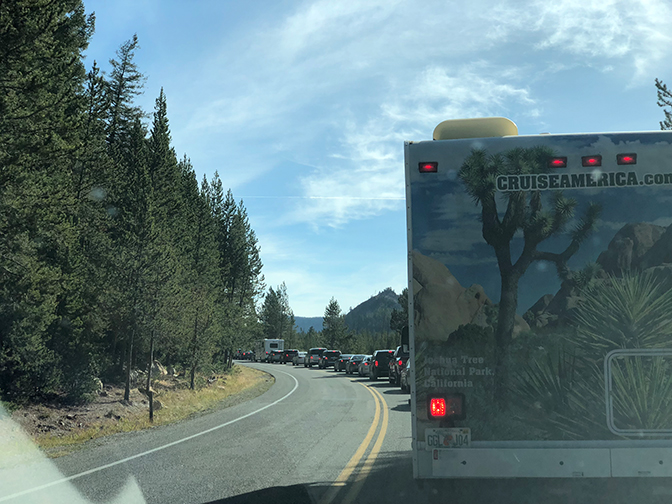
Through the windshield
My second full day in Yellowstone started with a traffic jam. After half an hour of inching along the road, I finally saw the reason for the hold-up: A entire herd of buffaloes was moving east between the road and the Madison River. Some of the buffaloes had found a nice place to roll cumbrously in the dust. Two males decided to spar. And I spotted a still-reddish baby buffalo in the group. If I’d been sitting in the passenger seat I could have reached out and touched some of these animals. As it was, for many of the photos I took I had to hold the camera up high to keep buffalo heads from being obscured by the door frame. And so, like everyone else on the road, I contributed to the traffic jam.
After the buffalo jam I hoped to visit a favorite of mine, Grand Prismatic Spring, but I gave up—cars spilled over from the parking lot all the way to the main road and more. Instead I spent an hour or so on Firehole Lake Drive, where there were few people but several interesting geysers and pools.


In the meadow between the geyser area and Firehole Lake, I stopped by this small stream and dipped my hand into the water. The morning was in the 40s, but the water was quite warm from the geyser runoff.

Stream, Firehole Lake Drive
Eventually I drove south to West Thumb Geyser Basin, on the edge of Yellowstone Lake. From here you can see hot springs, geysers, the lake, and the distant mountains all in the same view. It was tough to get people-free shots here, because the boardwalks were crowded with selfie-taking tourists—a people jam. But it was worth the jostling to see the lake and the brilliant colors of the two pools below, the most beautiful at West Thumb.


I walked twice as far as I expected to at West Thumb. As I was heading back to the car from the lake, a ranger closed the boardwalk ahead of me because a group of elk were getting too close to the crowds, or vice versa. I backtracked along the lake all the way around to the other side of the basin—where people also were, you guessed it, being turned back toward the lake because of a large bull elk. So I backtracked over my backtrack and found a middle route up the slope.
At this point my feet were aching and I was extremely glad that I’d packed cheese and crackers and grapes in the car. Despite the crowds, some of the restaurants in Yellowstone had already closed for the season. After my early picnic supper, I drove down to Teton National Park, where the blinding sun just before sunset rendered the mountains extremely hazy. The photo below, considerably tinkered with in Photoshop, was the best I could do, which is not saying much. After getting lost a bit, I discovered that my motel for the evening—actually a cabin at the Togwotee Mountain Lodge—was about 15 miles east. And so I ended up not really seeing the Tetons on this trip. After several sleepless nights and lots of walking, I knew I needed to head home the next day.
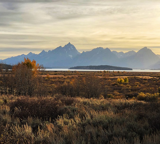
Tetons at sunset
But in the morning, before continuing east, I drove back about five miles west for a last glimpse of the mountains. And a wonderful visual effect occurred: As I rounded a curve, a mountain came into view on the horizon. Then another one, taller. Then another one, still taller. As the road continued curving, to my astonishment yet another mountain, massively tall, appeared. The Tetons are familiar to most Americans from countless movies and photographs. I’ve seen them on a couple of previous trips. Yet, like the Grand Canyon, they surprise you every time in person. I hope to go back.

Distant view of Tetons
When you’ve been away from a beautiful landscape, your memory loses some of the particulars of its beauty and changes others. That’s what I was thinking when I drove through the Lamar Valley (see last post). If Yellowstone had no geysers, no hot springs or mud pots or fumaroles—even if it had no elk and bison—it would still be a stunningly glorious place.
This day, however, I experienced another stunning aspect of Yellowstone: the sheer numbers of people. I knew it would be crowded, but I was astonished by just how crowded in was even in late September. The crowds included all sorts of people but were dominated by Japanese and, I think, Korean couples taking selfies at every pool, every geyser, every sign. Yet still I had a few moments by myself at Mammoth Hot Springs and at Porcelain Basin, part of the Norris Geyser Basin, literally the hottest spot in the park, with springs almost as hot as boiling, and highly acidic to boot.
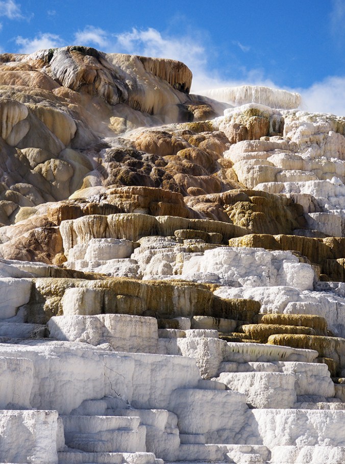
Palette Spring, Lower Terrace, Mammoth Hot Springs

Dryad Spring, Upper Terrace, Mammoth Hot Springs

Dead tree and dead spring, Upper Terrace, Mammoth Hot Springs
The oranges and reds in these photos are created by communities of thermophiles (heat-loving bacteria); the greens are created by communities of cyanobacteria (also thermophiles, but a very different kind, commonly called blue-green algae). When the source of a spring changes and the spring dries up, these organisms die, and only the chalky whiteness of the travertine formations remains.
Porcelain Basin is my favorite place in Yellowstone because of the lovely colors, many of them pastel but some brilliantly vivid. The features here include not only hot springs and geysers but fumaroles—essentially, steam vents. A light spray from these vents misted my skin and hair as I walked down into the basin.
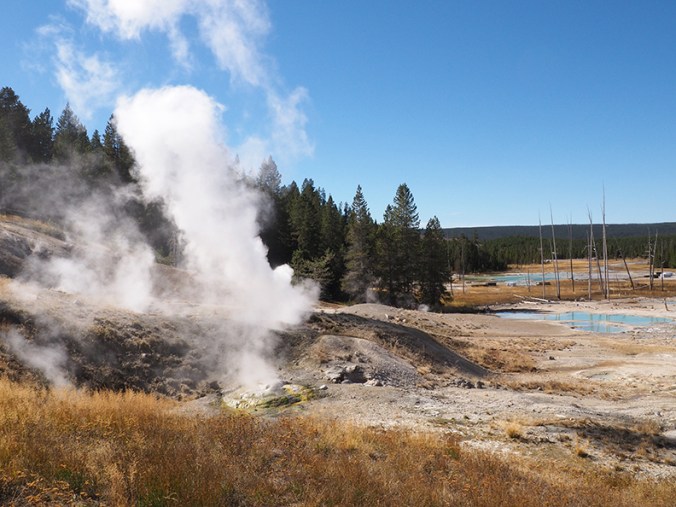
Fumaroles, Porcelain Basin

Hot springs, Porcelain Basin. The teal-blue comes, in part, from arsenic.

Cyanobacteria (blue-green algae) in runoff from a hot spring
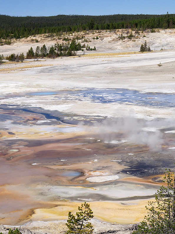
One overview, Porcelain Basin
After Porcelain Basin, I drove through the Madison River valley to West Yellowstone to secure a hotel room for the night, then got to Old Faithful at dusk. I’ve seen this geyser on several previous trips, but never saw so many people waiting for it to erupt. It was fortunate that I wasn’t anxious to get a good photo of Old Faithful, because it was almost dark and both of the batteries for my Olympus were exhausted. At the moment the geyser started to erupt, hundreds of cell phones were lifted up simultaneously by the people in attendance. To an alien it would have resembled some bizarre worship ritual. Here’s one of my obligatory iPhone photos—color noise and all—to cap off this day.
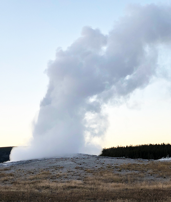
Old Faithful at dusk

Looking west over the Beartooth-Absaroka Mountains from Rock Vista Point
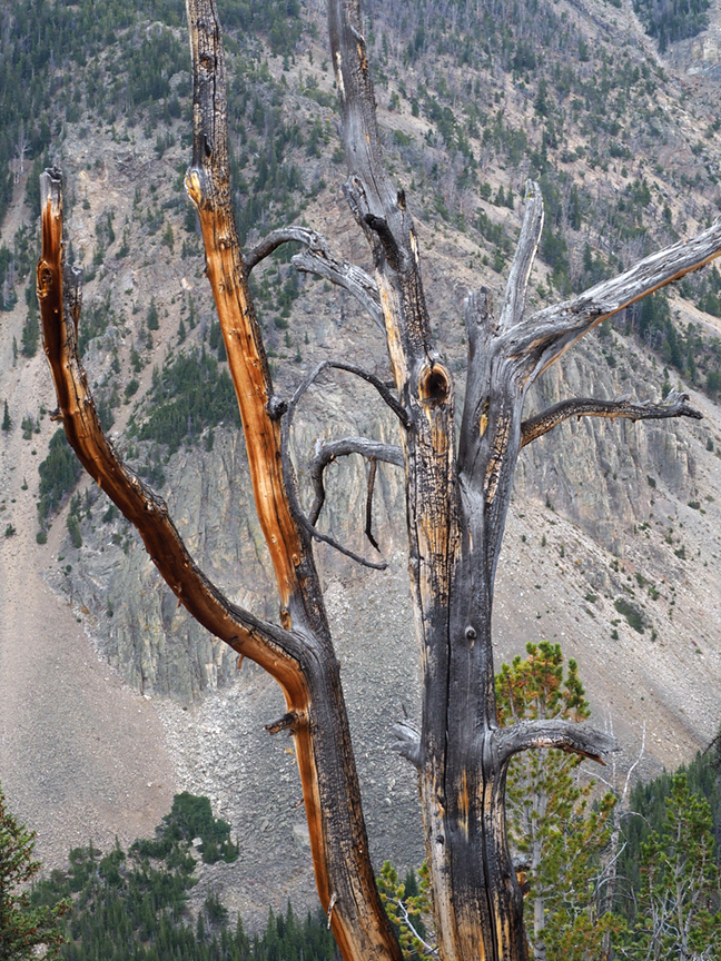
Tree against bare mountain slope
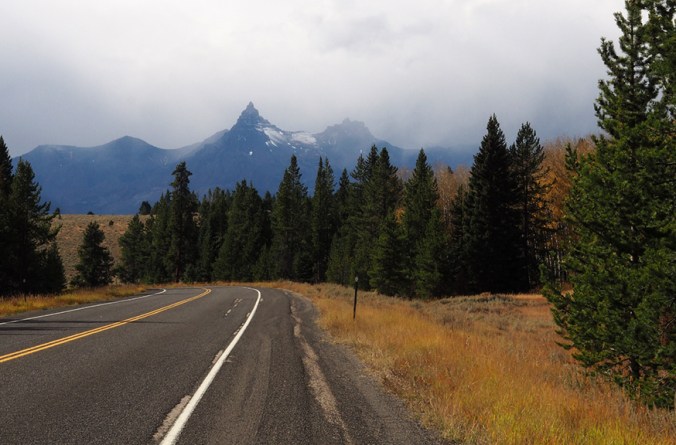
Picking my road trip back up where I left off: On Day 3 I took the Beartooth Scenic Byway from just southwest of Red Lodge, Montana, to Yellowstone. I’d heard how beautiful this route is, and even though the day was foggy, rainy, and finally snowy, what I’d heard was true. This is, according to Wikipedia, the highest-elevation road in Montana or Wyoming, and somewhere recently I read that the rocks exposed at Beartooth Pass (elevation 10,947 feet) are Pre-Cambrian, making them some of the oldest exposed anywhere in the lower 48 states. The drive is through glaciated terrain. Near the top of the pass is a large plateau with many small alpine lakes. It started snowing as I drove across the plateau, and at the pass itself the view was totally obscured. The wind was up and the temperature was down to 28 degrees, so I didn’t venture out of the car.

Plateau east of Beartooth Pass

Snow at Beartooth Pass
The weather gradually cleared as I descended the west side of the pass. Aspens, a waterfall, and distant peaks made this a beautiful drive. The highway, which begins in Montana and then dips down through Wyoming, curves back up to Montana and the small mountain town of Cooke City, where it was snowing. Heading out from Cooke City, you come to the northeast entrance of Yellowstone National Park.

Aspens west of Beartooth Pass
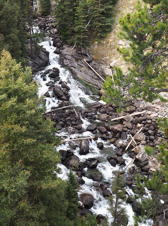
Waterfall west of Beartooth Pass
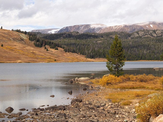
Lake west of Beartooth Pass
Pilot Peak
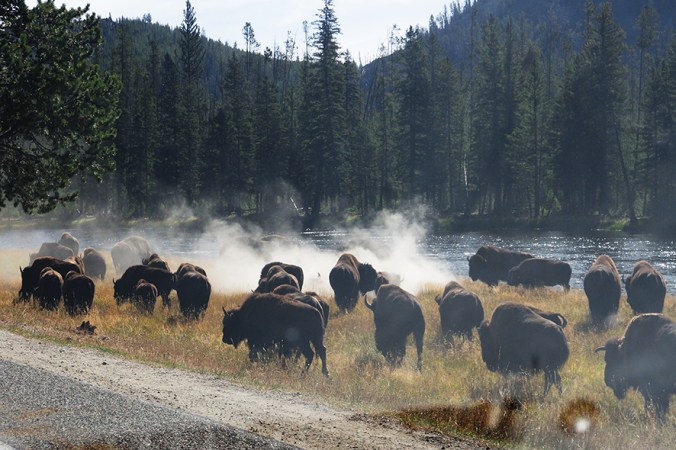
Almost as soon as I entered Yellowstone, I spotted two bison near the road. I was delighted. Well, little did I know that two bison were nothing compared to what was coming: whole herds! Buffaloes on the road, even. Buffaloes spread all across the Lamar Valley, where the snow had stopped, the sun had come out, and the meadows looked golden.

Buffalo closeup
Looking east from the Lamar Valley toward the Beartooth Mountains

Braided river in the Lamar Valley
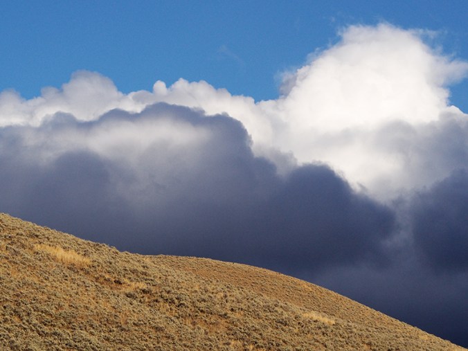
Cloud view to the southwest
As I got close to Mammoth Hot Springs, I could see steam rising from the far-off terraces. In town, elk were hanging out on the grounds of the local clinic. A couple of weeks earlier, a tourist had drawn the ire of a bull elk here and narrowly escaped injury. I parked at the clinic for a few minutes, where this bull elk was bugling and keeping his little harem pointed in the direction he felt was suitable. The sign in the clinic window, which I didn’t notice until I was looking at these photos, reads: “Elk present?!?! Use back door.” This elk certainly looked and sounded like he didn’t want to be trifled with, and I took this photo through the windshield. Tomorrow: Hot springs and geysers!

Bull elk, Mammoth Hot Springs
Verbena

Balloon flower
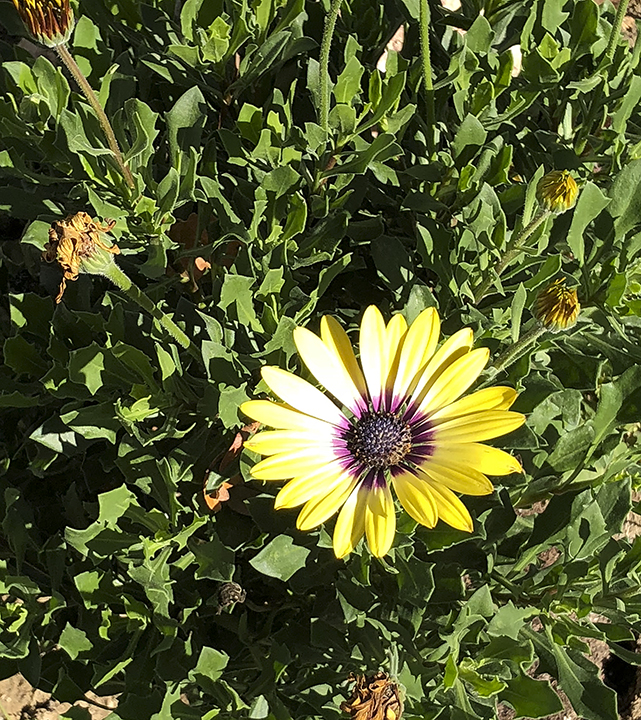
African blue-eyed daisy

Purple dalmatian foxglove
On October 13 in Loveland, Colo., the day before a hard freeze and a six-inch snowfall, the flowers I’d planted on the west side of my house were still going pretty strong. That was no thanks to me, since I’m a novice gardener and not strong enough or educated enough to do the proper things, like amending the soil and fertilizing. (All I know how to do is buy the plants at Lowe’s and plop them into the dirt.) But these flowers have been very forgiving of me for the past few months. I was especially surprised to see foxglove blooming in October. And even now, on October 24, after the snow and the cold, the verbena still has blossoms. Even if the perennials among these don’t overwinter, I’ve gotten my money’s worth of enjoyment out of them.
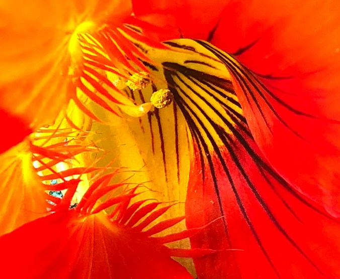
Nasturtium
This nasturtium graced my breakfast plate at the Regis Café in Red Lodge, Montana. I don’t recall ever having been served a flower before. A fellow diner told me that nasturtiums are delicious, but I just photographed mine with my iPhone and then took it in the car with me.

Warped blinds
Taken at an abandoned gas station in Powder River, Wyoming.
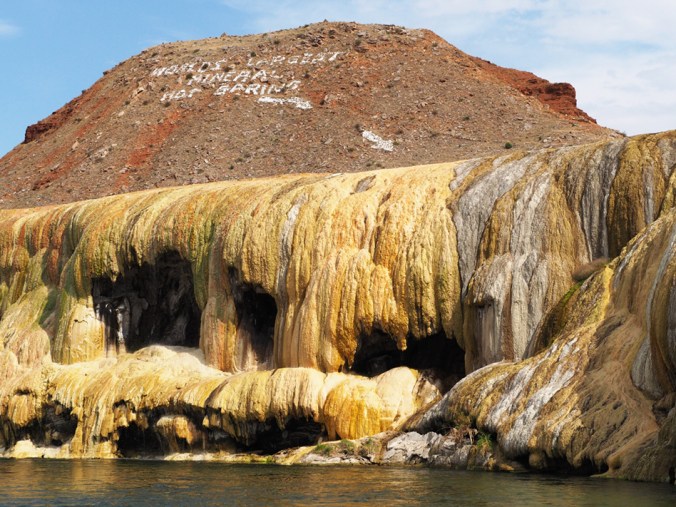
Hot Springs State Park, Wyoming
I spent part of Sunday at Hot Springs State Park in Thermopolis, Wyoming. This site is billed as having “The World’s Largest Mineral Hot Spring” (see photograph). The springs, which feed three bathhouses/pools in the park, were acquired from the Shoshone and Arapaho in a 1896 treaty with the stipulation that they be maintained free of charge for everyone. So far, that stipulation has been honored. I didn’t have time to visit any of the bathhouses—and hadn’t brought a swimming suit, not having read up on Thermopolis before I left Loveland. But that was okay; the previous day’s drive had been hot in advance of a front (87 degrees west of Casper in late September!), and I was relishing the refreshing coolness on Sunday. I was also relishing the lack of crowds while I had the chance; things would be very different at Yellowstone.
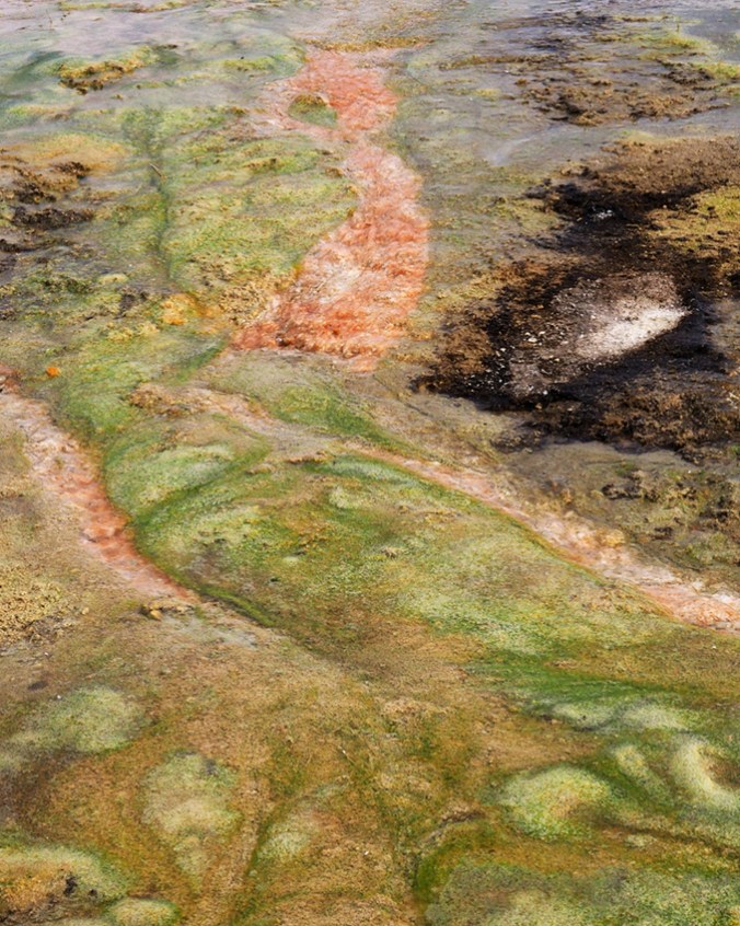
The park has several places to see the travertine formations created by runoff from the springs. The travertine is deeply “stained” by heat-loving bacteria, making a colorful sight. One of the most interesting things about the hot springs area is the profuse growth of cyanobacteria (blue-green algae) in the runoff. These bacteria form long, thick mats that ripple in the current like hair. The water where they grow is about 110 degrees Fahrenheit. Reddish and orange bacterial mats predominate where the water is warmer.
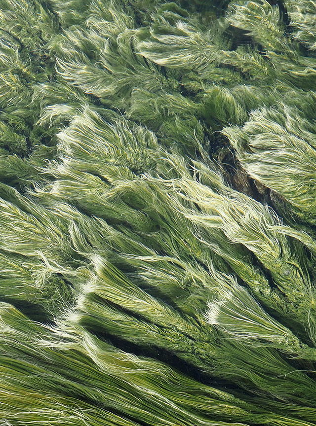
Streamers of cyanobacteria live in the runoff channels at Hot Springs State Park
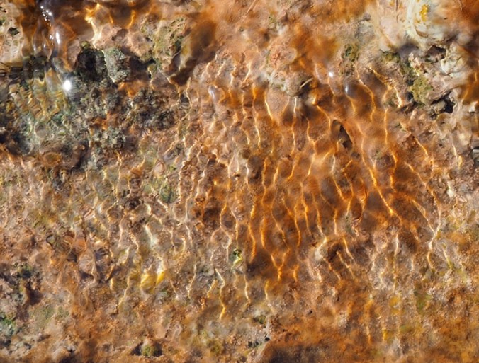
Heat-loving bacteria are responsible for the red, orange, and yellow colors
A mix of bacteria (reddish-orange) and cyanobacteria (green)
The park is on the Bighorn River, which is actually the downstream reaches of the Wind River. The dual names resulted from the fact that, until Wind River Canyon was discovered, no one realized that the Wind River cuts north through the Owl Creek Mountains. Just south of Thermopolis, it becomes the Bighorn. The original Crow (Apsáalooke) word for the Bighorn is a whopper: lisaxpúatahcheeaashisee, “which translates to English as Large Bighorn Sheep River” (thanks, Wikipedia).
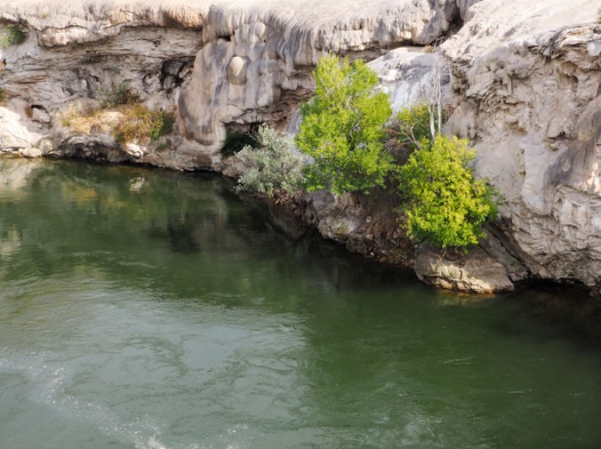
Bighorn River north of Thermopolis
Besides the hot springs, the park also features a suspension bridge over the Bighorn River and a drive through a hilly range that’s home to a buffalo herd. The red sandstone hills surrounding Thermopolis date back to the early Triassic and are called the Red Peak Formation (part of the larger Chugwater Formation). According to a park sign, the nearly 600-foot-thick formation is almost devoid of fossils because one of the planet’s great extinction events had taken place at the beginning of the Triassic.

Hot Springs State Park, Wyoming. The green in the water is long mats of blue-green algae (cyanobacteria), which thrive in the warm water.
On the (fenced) range at Hot Springs State Park, Wyoming

Part of the bison herd at Hot Springs State Park, Wyoming
I spoke to a man who was using a decoy dummy to train two 8-week-old pups to retrieve ducks. They were splashing in a little inlet of the Bighorn River where there was runoff from a large hot spring. The water temperature at that location stays in the 70s year-round, he said. The pups were having a blast but were more interested in playing and checking out visitors than retrieving the dummy. They were joyful, muddy, and very, very wet.

Pups being trained to retrieve ducks
Next up: A visit to the Wyoming Dinosaur Center.
Some non-scenic sights from my recent road trip to Wyoming/Montana.


